Methodology of 0.625°×0.4712° raster dataset development of temperature at the top of permafrost and active layer thickness in the Northern Hemisphere (2015-2100)
Abstract
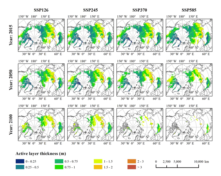
Understanding the spatial distribution and dynamics of current and future permafrost is critical for global carbon flow simulation, climate change prediction, and engineering risk assessment. The 0.625°x0.4712° raster dataset of temperature at the top of permafrost and active layer thickness in the northern hemisphere (2015-2100) was developed using the widely validated and applied Kudryavtsev method, which integrates the effects of temperature, snow, vegetation, and soil on permafrost, based on the model outputs from the sixth phase of the International Coupled Model Intercomparison Project (CMIP6) and the SoilGrids 2.0 dataset. The data were calculated under four different scenarios, SSP126, SSP245, SSP370, and SSP585, from 2015 to 2100. The permafrost area was obtained based on the temperature at the top of the permafrost. This dataset fills the gap in permafrost distribution data for the future under different scenarios for CMIP6. It includes the data covering 2015-2100: (1) mean annual temperature at the top of the permafrost; (2) annual active layer thickness; and (3) annual permafrost area. The resolution of the spatial data is 0.625°x0.4712°. The dataset is archived in .tif and .xls data formats, and consists of 690 data files with data size of 35.6 MB (Compressed to one single file with 27.9 MB).